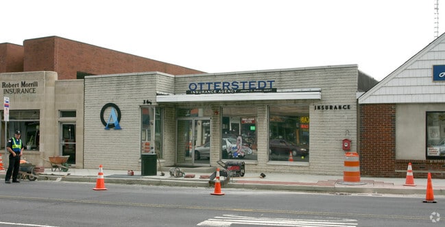
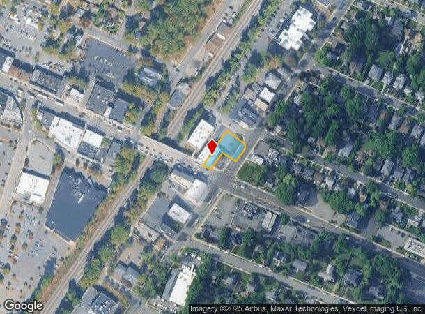
Property Record
363 Cedar Ln, Teaneck, NJ 07666
NEARBY LISTINGS FOR SALE OR LEASE
Property Detail
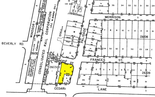
363 Cedar Ln
New York-Jersey City-White Plains, NY-NJ
125X95
60-02603-01-00003
Bergen
Commercialnec
New Jersey
X
3
34003C0194H
0.27 AC
2024
Teaneck/Ridgefield
2025
Northern New Jersey
054500
DEMOGRAPHICS near 363 Cedar Ln
1 Mile
3 Mile
5 Mile
2024 Total Population
24,190
214,518
525,549
2029 Population
23,993
212,796
519,124
Pop Growth 2024-2029
(0.81%)
(0.80%)
(1.22%)
Average Age
41
41
42
2024 Total Households
7,985
79,347
198,383
HH Growth 2024-2029
(0.90%)
(0.79%)
(1.24%)
Median Household Inc
$127,667
$91,597
$96,040
Avg Household Size
2.80
2.60
2.60
2024 Avg HH Vehicles
2.00
2.00
2.00
Median Home Value
$463,750
$443,225
$479,084
Median Year Built
1947
1956
1957
Nearby Places
Map Layers
Map Styles
 Street
 Aerial
- Restaurants
- Banks
- Shops
- Fitness
- Groceries
PUBLIC TRANSPORTATION
COMMUTER RAIL
Anderson Street (Pascack Valley Line - NJ Transit Commuter Rail (NJ Transit))
DRIVE
WALK
Distance
Anderson Street (Pascack Valley Line - NJ Transit Commuter Rail (NJ Transit))
4 min
1.5 mi
New Bridge Landing (Pascack Valley Line - NJ Transit Commuter Rail (NJ Transit))
DRIVE
WALK
Distance
New Bridge Landing (Pascack Valley Line - NJ Transit Commuter Rail (NJ Transit))
5 min
2.6 mi
AIRPORT
LaGuardia
DRIVE
WALK
Distance
LaGuardia
28 min
15.8 mi
Newark Liberty International
DRIVE
WALK
Distance
Newark Liberty International
22 min
17.8 mi
Westchester County
DRIVE
WALK
Distance
Westchester County
49 min
31.6 mi
Freight Ports
NY - Red Hook Container Terminal
DRIVE
WALK
Distance
NY - Red Hook Container Terminal
37 min
20.6 mi
Nearby Properties
Address
Land Use
TOTAL SIZE
Lot Size
Zoning
Address
Land Use
TOTAL SIZE
Lot Size
Zoning
488,779 SF
7.55 AC
HCS
Address
Land Use
TOTAL SIZE
Lot Size
Zoning
988,414 SF
34.89 AC
BG
Address
Land Use
TOTAL SIZE
Lot Size
Zoning
4.37 AC
HCS
Address
Land Use
TOTAL SIZE
Lot Size
Zoning
512,862 SF
14.16 AC
Address
Land Use
TOTAL SIZE
Lot Size
Zoning
281,720 SF
3.93 AC
R-3
Address
Land Use
TOTAL SIZE
Lot Size
Zoning
572,137 SF
14.11 AC
R-D
Address
Land Use
TOTAL SIZE
Lot Size
Zoning
20.07 AC
H
Address
Land Use
TOTAL SIZE
Lot Size
Zoning
102,070 SF
29.70 AC
BL
Address
Land Use
TOTAL SIZE
Lot Size
Zoning
74,550 SF
11.28 AC
OI
Address
Land Use
TOTAL SIZE
Lot Size
Zoning
608,596 SF
27.10 AC
LID
Address
Land Use
TOTAL SIZE
Lot Size
Zoning
13.09 AC
C3
Address
Land Use
TOTAL SIZE
Lot Size
Zoning
232,368 SF
5.10 AC
Address
Land Use
TOTAL SIZE
Lot Size
Zoning
197,742 SF
6.20 AC
R3
Address
Land Use
TOTAL SIZE
Lot Size
Zoning
25,620 SF
21.37 AC
Address
Land Use
TOTAL SIZE
Lot Size
Zoning
5.22 AC
APT
Address
Land Use
TOTAL SIZE
Lot Size
Zoning
4.54 AC
R-M3
Address
Land Use
TOTAL SIZE
Lot Size
Zoning
250,833 SF
13.49 AC
BG
Address
Land Use
TOTAL SIZE
Lot Size
Zoning
2.55 AC
RC-1
Address
Land Use
TOTAL SIZE
Lot Size
Zoning
261,303 SF
5.60 AC
O
Address
Land Use
TOTAL SIZE
Lot Size
Zoning
303,434 SF
13.34 AC
Address
Land Use
TOTAL SIZE
Lot Size
Zoning
Address
Land Use
TOTAL SIZE
Lot Size
Zoning
394,046 SF
1.88 AC
R3
Address
Land Use
TOTAL SIZE
Lot Size
Zoning
2,191 SF
1.34 AC
B2
Address
Land Use
TOTAL SIZE
Lot Size
Zoning
13 AC
B-3
Address
Land Use
TOTAL SIZE
Lot Size
Zoning
31,896 SF
1.64 AC
O
Address
Land Use
TOTAL SIZE
Lot Size
Zoning
2.92 AC
RC-2
Address
Land Use
TOTAL SIZE
Lot Size
Zoning
5.53 AC
RS
Address
Land Use
TOTAL SIZE
Lot Size
Zoning
340,218 SF
8.69 AC
B-3
Address
Land Use
TOTAL SIZE
Lot Size
Zoning
Address
Land Use
TOTAL SIZE
Lot Size
Zoning
431,600 SF
2.70 AC
R3
The World's #1 Commercial Real Estate Marketplace
Connect with us
© 2025 CoStar Group
The information above has been obtained from sources believed reliable. While we do not doubt its accuracy we have not verified it and make no guarantee, warranty or representation about it. It is your responsibility to independently confirm its accuracy and completeness. Any projections, opinions, assumptions, or estimates used are for example only and do not represent the current or future performance of the property. The value of this transaction to you depends on tax and other factors which should be evaluated by your tax, financial, and legal advisors. You and your advisors should conduct a careful, independent investigation of the property to determine to your satisfaction the suitability of the property for your needs.